First report 1h ago•Last update 1h ago
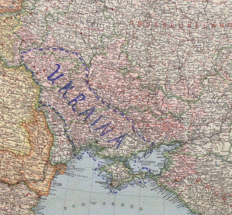
Historical Map of Envisioned Ukrainian Borders from 1915 Published
A historical map from 1915, depicting German diplomats' envisioned borders for a 'free Ukraine', has been recently published, sparking discussions about historical territorial claims.
Background
Ukraine and Russia have been engaged in a prolonged conflict since 2014, escalating significantly in 2022. This has led to ongoing international diplomatic efforts and discussions about Ukraine's sovereignty and territorial integrity, involving major global powers.
Quorum · collective opinions
Historical Maps and Border Discussions Regarding Ukraine
First report 3h agoLast update 3h ago1 takes 1
historical map publicationneutralShow 1 post
started 3h ago•Last update 3h ago
A historical map from 1915, showing German diplomats' plans for a 'free Ukraine,' has been published for the first time.
iWitness comments
No comments yet — be the first to weigh in.